Maf Wrote:
Maybe we need an online map where all the fantasy lifts and runs could be marked on ? That's a bit beyond my technical ability though !
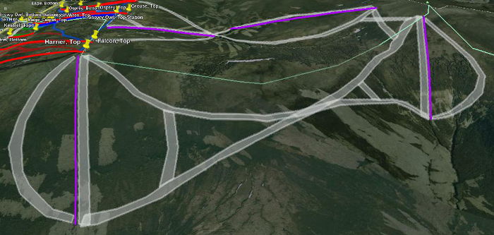
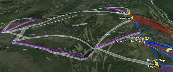
Hi Maf, this is relatively easy to do if you have the PC version of Google Earth. All you have to do is draw "paths" on the map to represent lifts and polygons for the runs. There is a tutorial here: [
support.google.com]. The result can be saved as a KMZ file and uploaded to websites/forums etc if you want to share them. Alternatively, you can save the current view as an image. eg, this is what you could do at the Lecht:


If you download my Google Earth overlay, you'll find that all of the hard work in terms of mapping the existing infrastructure has been done for you. It's based on a combination of GPS traces and aerial image analysis.
[
www.my-place.org.uk]
The full version of the overlay also includes historical information and published but un-built expansion proposals. This is all hidden by default, but ticking the relevant boxes will cause it to pop up. I've also included a load of my own personal "Fantasy" improvements.
If you don't have Google Earth, you can still click on the "View in Google Maps" link to see the core overlay information.
Out of interest, if anybody out there has a decent set of GPS traces from the Back Corries (and The Nid Wall) at Nevis showing the (nominal) official routes to the foot of the Braveheart, I'd love to have a copy (please PM me). I haven't been able to coincide a visit to Scotland with this lift being open for over 10 years, so I've never mapped it properly and it's very difficult to tell from the aerial images where the routes actually are.
Edited 3 times. Last edit at 19.39hrs Sun 1 Mar 15 by tim1mw.
Attachments:
lecht-expand-north.png (350kB)
lecht-expand-south.png (330kB)